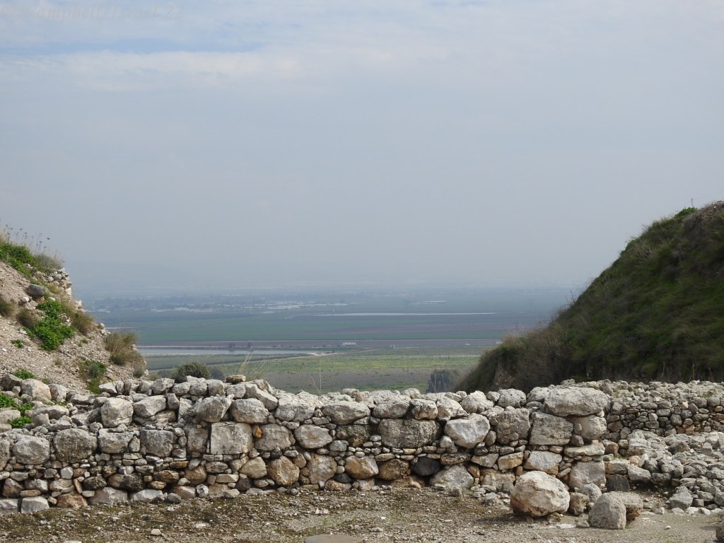
Battles had been fought here. The site is a strategic one. As we stood at Megiddo and looked out over the Jezreel Valley4, war was just about the furthest thing from my mind. The view was incredibly beautiful. The sky was incredibly blue with soft white clouds scattered to the horizon. In the distance across the valley, we could see farms divided into neat squares either planted with winter crops or being prepared for the summer in ombre layers of green and brown and tan.

Just to my right I saw a couple of cows grazing with the requisite Cattle Egret which I had to take a picture of, of course. It was a bird, after all, and everyone knows how much I love birds. At that moment, there was only peace; nothing in that place, in that valley, spoke to me of war or battles or the end of time.

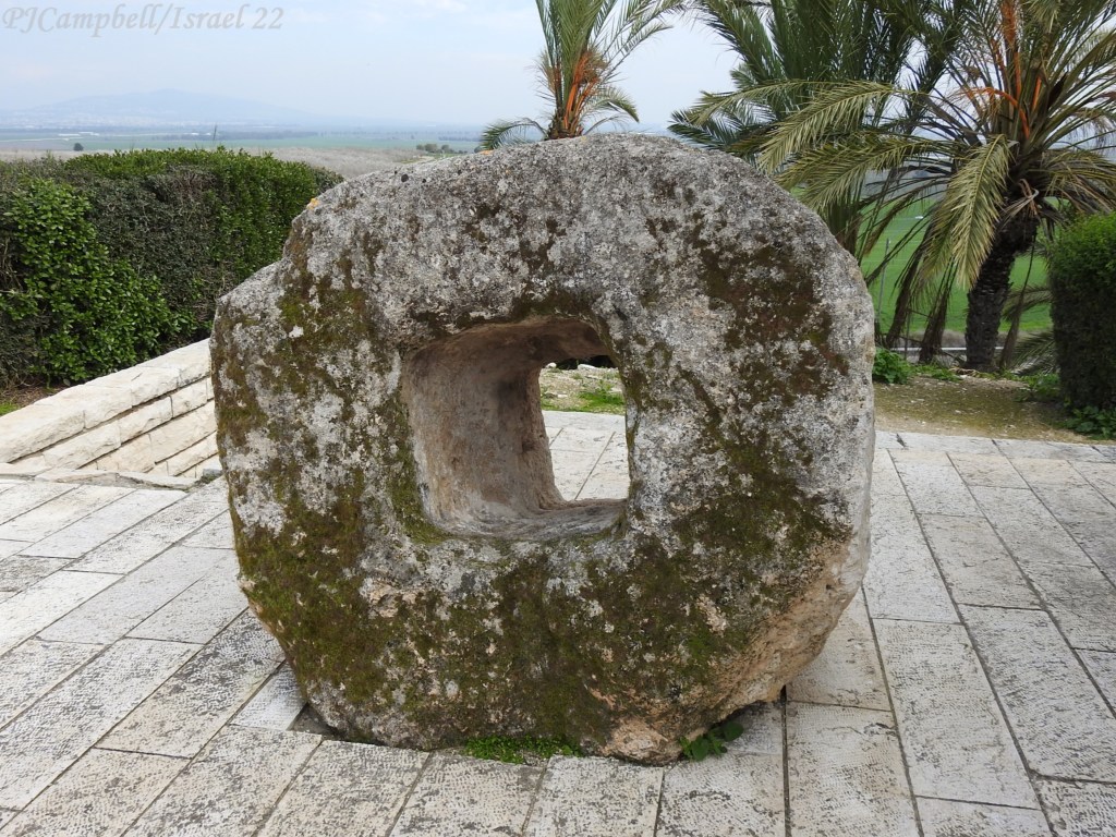
I was standing on the top of Tel Megiddo1. A “tell” is an archaeological mound built over hundreds of years as cities rise and fall in the location and new cities are built in the same location using the previous ruins as foundations for the new cities. Archaeologists believe that there are about 20 levels or strata of ruins at Megiddo with an overlap of Egyptian, Hittite, Mitanni, Assyrian, and Israeli peoples occupying the site at differing times over the centuries with the primary inhabitants being those of Israel, Philistia, and Phoenicia.

Megiddo is strategically located near the mountain pass through the Carmel Ridge. This is the ancient trade route called Via Maris2 (“by way of the sea”) taken by traders traveling between Egypt and Assyria and Babylon – from north Africa to Asia. This area has been inhabited since about 7000 BCE (before the common era) or BC (before Christ) to me. The pass was always guarded so Megiddo was always fortified…. it is listed as one of Solomon’s chariot cities where many of his horses were stabled and war chariots were kept. Invariably, as long as this city controlled the pass through the mountains to the east, there would always those who would fight to control it.1

Three major battles have been fought in the area that were named the “Battle of Megiddo” (see references 5, 6, & 7 below) and a whole plethora of no-named skirmishes. I got totally caught up in the online reading about these battles and the history of this place. It is such fascinating history. But I will spare you with all the details.

But I am not thinking about all this war stuff when we visited the site. From the top of Tel Megiddo, the peaceful Jezreel Valley was laid out before me. This valley is one of the most fertile spots in all of Israel. When we embarked on this tour, I had a vision of Israel as a dry hot desert – you know the kind of geography – with Jesus walking around in dusty leather sandals in the wilderness hungry & thirsty in the sweltering heat while being tempted by the devil. I suppose I thought that all of Israel would be that way – hot, rocky, dry, and dusty.
In this valley, you just cannot imagine the devil tempting Jesus – maybe I could see him tempting Adam & Eve to eat of the fruit of the tree up here at Jezreel…. but certainly not tempting the son of God to turn stones into bread (Matthew 4:1). For how could anyone go hungry or thirst up here in the land of plenty? Surely, this is the promised land that Joshua scouted out way back there in the book of Numbers (chapter 14). This is definitely not the wilderness where Jesus was tempted…not even close.
The land here is good and there is plenty of water from the springs at Carmel. Even the name “Jezreel” is derived from a Hebrew word, “Yizre’el” meaning “God sows”4. They grow all sorts of things here like oranges and watermelons and wheat and beans and cotton and sunflowers and chickpeas – of course, chickpeas, you just can’t make hummus without chickpeas. I cannot imagine what the restaurants in Israel would do without hummus and pita bread!
And I cannot imagine war here in this peaceful beautiful place.

But this is Armageddon. The place where it is prophesied that the war to end all wars will be fought. From the Greek “Har” (mount) and “Megiddo”, we get Armageddon9. It is the place noted in Revelation 16:16 where nations will gather in the final confrontation between the forces of good (God) and the forces of evil (Satan) “for the great day of the Lord” from Revelation 16:14. Over the past two thousand years, the word has come to mean any world ending catastrophe, any great conflict that would end life as we know it here on earth. Prophecies about the end times abound throughout the Bible. Yet the only cite in the Bible predicting that last great battle to be fought at the Valley of Jezreel or Armageddon is Revelation 16:16. Some theologians and historians say that the battle to be fought in this valley is all symbolic and not necessarily ever going to happen at all…. that the reference is all about conflict in the middle east in general.

But I’m a literalist when it comes to scripture – if the Bible says there will be a final confrontation in this valley at this place, then you had best believe that it’s gonna happen in the Jezreel Valley – right there in that same valley I could see spread out in front of me as I stood on Tel Megiddo.
Scriptural Cites:
- Joshua 12:21 – In the list of kings defeated by Joshua, the king of Megiddo.
- Joshua 17:11 & 12 – Megiddo was given to the tribe of Manasseh although Manasseh never conquered the city/land.
- Judges 1:27-28 – Manasseh fails to drive the Canaanites out of Megiddo.
- Judges 5:19-20 – The victory song of Deborah & Barak speaks of the waters of Megiddo.
- Judges 6:33 – Gideon defeats the Midianites, the Amalekites, & the “children of the east” 3 in the Valley of Jezreel.
- Joel 3:2 – All nations will be brought to the Valley of Jehoshaphat which is believed to be the Valley of Jezreel.
- Zechariah 12:2-11 – On that day, the day of wailing in Jerusalem will be as great as the weeping of Hadad Rimmon in Megiddo.
- 1 Samuel 28:4 – Philistines gather against Israel & King Saul at Gilboa in the Jezreel Valley.
- 1 Samuel 29:1-6 – King Saul defeated by the Philistines in the Jezreel Valley
- 1 Kings 4:12 – King Solomon’s governors include Baana in Taanach & Megiddo.
- 1 Kings 9:15 – King Solomon uses forced labor to build cities including Megiddo
- 1 Kings 10:26 – King Solomon’s chariots and horses kept at the “chariot cities” one of which was Megiddo
- 2 Kings 23:29–30 & 2 Chronicles 35:22 – King Josiah is killed at Megiddo by Necho II of Egypt
- 2 Kings 9, King Jehu (10th king of Israel) killed all the family members of the House of Omri (King Ahab & Queen Jezebel) in the Jezreel Valley.
- 2 Kings 9:27 – King Ahaziah of Judah in the battle with Jehu escapes to Megiddo, is wounded & dies there.
- 1 Chronicles 7:29 – Holdings of the descendants of Ephraim are shown to include Megiddo.
- Matthew 4:1 – Jesus tempted in the wilderness.
- Revelation 16:12-16 – Place of end times gathering of nations/kings identified as Armageddon
- Numbers 14:36-38 – Joshua & Caleb sent to the promised land.
Sources for Additional Information About Megiddo & The Jezreel Valley:
(Other than the Biblical cites listed above, my research comes from Wikipedia as shown below.)
- Tel Megiddo – Wikipedia
- Via Maris – Wikipedia
- Canaan – Wikipedia
- Jezreel Valley – Wikipedia
- Battle of Megiddo (15th century BC) – Wikipedia
- Battle of Megiddo (609 BC) – Wikipedia
- Battle of Megiddo (1918) – Wikipedia
- Revelation 16 New American Standard Bible (biblehub.com)
- Armageddon – Wikipedia
- Book of Kings – Wikipedia
- Book of Chronicles – Wikipedia
ICYMI (In case you missed it) – Previous blogs in the Israel 2022 series:
Pinch Yourself – April 4, 2022
Israel 2022: Caesarea Maritima – Birding Boomers – April 11, 2022
Israel 2022: Contested on Mount Carmel – Birding Boomers – April 20, 2022
 If you missed Days 1 – 3 of this series, you can catch up here (
 There were a few places we wanted to visit along the river which seemed to be a hotspot for state recreation areas and wildlife management areas (WMA’s). Since I wasn’t really sure about the dates for hunting season in Nebraska and WMA’s are usually more rustic in terms of access roads, we elected to check out the SRAs and do a little more birding around
  So, we headed out back, through a parking lot, down an access road, past the hockey arena and over towards the ponds and the geese. We were not disappointed. There was a large flock of Snow Geese interspersed with Canada Geese, a scattering of Red-Winged Blackbirds, and a few Killdeer. The highlight was getting close looks at several grey or blue morph Snow Geese. Not bad birding and a good start for the day. You just never know where a birding hotspot is going to be. Birds are sometimes in the most unlikely of places and not always in the preserves and refuges where you would expect them to be….although what goose can resist a good pond in the morning?
 Then it was back onto Interstate 80 and heading up to
 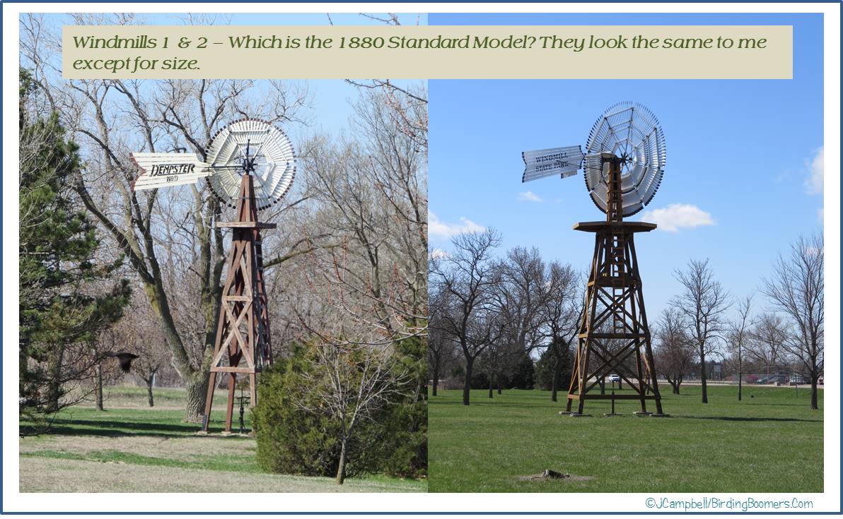 At any rate, the oldest windmill was supposed to be an 1880 Standard that was moved down from Fleming, Colorado where it had previously been used to pump water for steam locomotives. Since we only found two (2) windmills in the park (how can you miss something as big as a windmill?) and I have no idea which is the Standard model, I will post the photos and you can decide for yourself.
 Per the explanation for a
  Then it was over the Interstate and back to
  Roaming on down the road, we were totally delighted to find a Ring-Necked Pheasant strutting across the field obviously trying to catch the attention of some female we could not see. As we came to a bend in the road, we spotted a Western Meadowlark perched on the “curve” sign singing his heart out….just a lovely day altogether.
 Towards the far backside of the Sanctuary property, there is a small creek that empties into the river that attracts waterfowl and cranes. A vehicle pull-off with a blind has been built there by the road that makes a great spot for watching the birds on and around the water. Why hadn’t the staff at the Visitor Center mentioned this great spot?
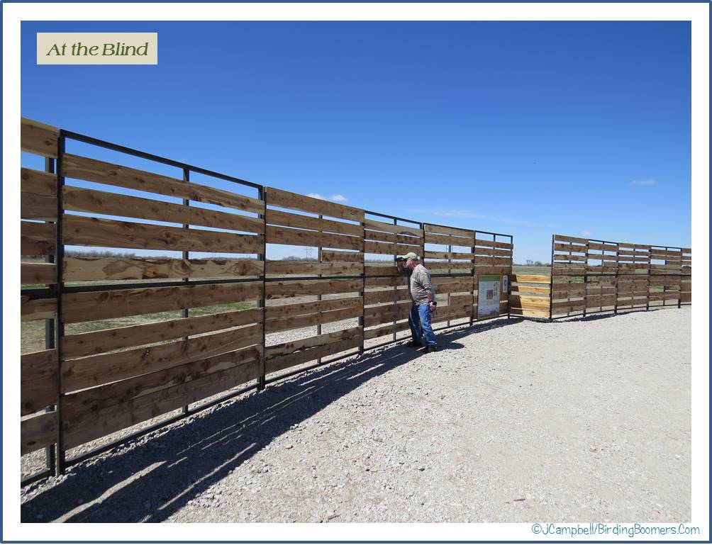 It was marvelous and we spent a little time there before moving on down the road…..and more road and more road…all of it dirt.
 Next stop –
 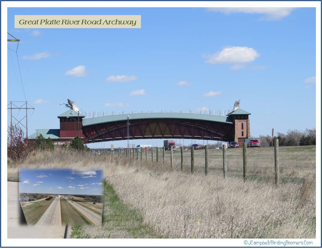 The Great Platte River Road Archway
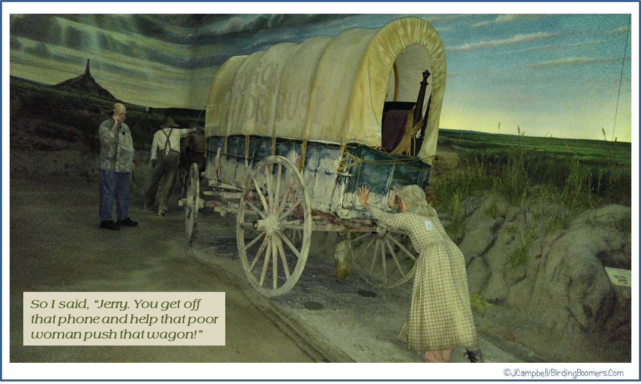 The museum had been recommended to us as a neat place to visit and very interesting….not that the fact that it spanned the highway wasn’t incentive enough…so we decided to give it a go. The museum was not crowded on this afternoon….well, I think we might actually have been the only visitors at the moment we entered the building although there were some folks looking around outside. Since I’m not crazy about crowds, it was ideal.
 We were met at the door by docents dressed in pioneer costumes and pointed to the ticket window to get tickets and listening aids for the programmed guided tour and then we headed up the escalator and started the tour.
 Let me take a moment and give one story that goes along with the photo I’ve included showing a statue of two children speeding off on a horse. It seems that these two young boys, the Martin Brothers, are very well known in the history of the area. In the Indian uprising in 1864, George Martin and his two sons were working in the fields loading hay when they were attacked by a band of Sioux Indians. As the father tried to fight off the Indians, the two boys jumped on a horse, riding double, and headed home. As the boys fled the scene, one of the Indians fired an arrow at them. The arrow passed through Nat’s body and lodged in Robert’s back….knocking both boys off the horse. The Indian, thinking they were pretty much dead, did not bother to check further and so, fortunately, did not scalp them. Both boys survived although Robert never recovered from the back injury. Per the reports, Nat lived to tell the story of his escape to his grandchildren.
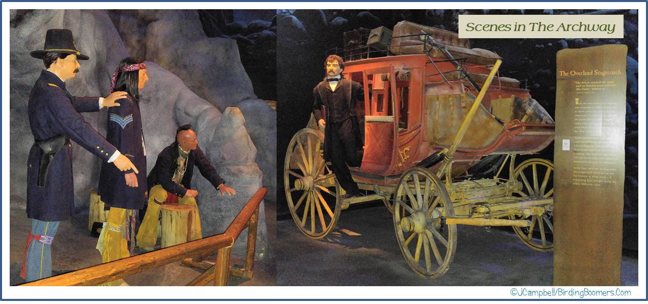

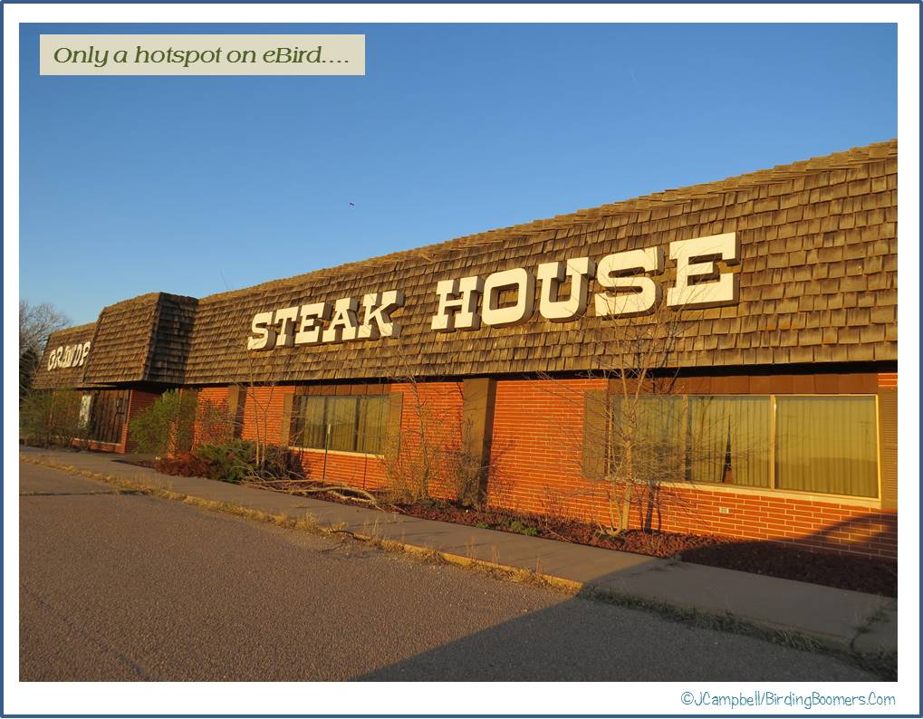 Before supper, we did a little birding in a neighborhood near the hotel. Grandpa’s Steak House, sadly, is no longer in business but it lives forever as a hotspot on